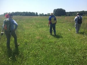
We spent much of this month in the field. When I say “field,” I mean literal fields on the rolling plains of Prairie D’Ane, a centuries-old blackland prairie just north of Prescott, Arkansas. It is a beautiful place, with sweeping vistas and a great blue dome of sky. It was also a place where, in 1864, thousands of people came together to do battle. Prairie D’Ane was one of the battles of the Camden Expedition of 1864, which was the U.S. Army’s attempt to cross southwest Arkansas and invade Texas.
Several decades ago, Mark Christ, of the Arkansas Historic Preservation Program, started working to preserve a portion of the battlefield. In recent years, Mark and dozens of volunteers from Prescott, Little Rock, and farther afield sought to raise funds to acquire an 800 acre tract. With help from AHPP, the Civil War Trust, and many, many others, they were successful, and the purchase went through earlier this year.
With the land acquired, AHPP asked the Arkansas Archeological Survey to figure out where the footprint of the battle was within that tract and to see what of the battle we could recover. Accordingly, we spent three weeks this month conducting systematic metal detector sweeps across a large portion of those 800 acres. This is what we learned:
- Our volunteers are fantastic! We had 26 different people from Arkansas, Texas, Oklahoma, and Louisiana chip in 460 hours of volunteer labor. Our greatest thanks to all of those who came out and helped!
- This was, in many ways, a much harder project than some others. The land to be covered was almost twice as large as Elkins’ Ferry, which we did in 2016. It is much less-well documented than Pea Ridge. The land has not been protected from relic hunters until recently, so it has been picked over a lot in the past fifty years. Still…
- We found a good collection of war-related artifacts. There were bullets for infantry and cavalry weapons. We recovered three cannonball fragments, all for 12-pounders. Our work at Elkins’ Ferry (which took place a few days before Prairie D’Ane) recovered only 6-pounder artillery ammunition, so we can tell we had different units playing a role here.
- I think we found a cannon position, probably a federal one. Just downslope from one of the ridge crests, we started finding some long strips of tin-backed lead. I’ve seen dozens of these at Pea Ridge, and they are fragments of sabots for a kind of cannon known as a James rifle. Interestingly, right in that same area lay one of our cannonball fragments. Maybe that was some counter-battery fire.
- The battle may have been farther west than some thought. A lot of historical sources use Arkansas 19, which crosses I-30 at exit 46, as the wartime Military Road. If that’s true, then there should have been artifacts right up to the road. They weren’t. When we did start finding them, we also happened upon an old, deeply-incised road bed. I think that is the Military Road of the time.
We’re shifting gears right now, as the University of Arkansas Field School and Arkansas Archeological Society Training Program are upon us, so we’re going to be at Pea Ridge for the next month. That’s going to be another battlefield project, in many ways, but on a different scale with different goals. We’ll keep you posted!
Carl Drexler
Station Archeologist

